Saturday, November 8, 2008

Dana Point CA


Date: 11/8/2008
Location: Dana Point CA
Lat/Lon: 33 27.587 W 117 41.925 W
Weather: 75°, winds NW 5-10kts

We're in Dana Point now and it's time to catch up since our last entry.

After Half Moon Bay we went to the following locations -

Monterey - This is a center of tourist activity with large hotels, high end shops, and restaurants of all kinds. We got a slip among the commercial boats but we were close to the center of activity in the town. The downside is that it's a long walk to a full size grocery store, the nearest store is a Trader Joe's which is more of a high end speciality store. We left at 4 AM for the next passage.

San Simeon - We anchored here in mild swells and left the fish in the water to ease the movement of the boat. Not much here and we didn't go ashore arriving late in the day and leaving early the next morning.

Port San Luis - This is a protected bay on the south side of Point San Luis. We called the harbor patrol and got a mooring ball here for the night. Our next passage was around Point Arguello and Point Conception both of which have a reputation of being very nasty so we decided to leave Port San Luis late in the afternoon and round the points at night when we hoped they would be calmer and give us a better passage. The plan worked except when we rounded Point Conception where all of the guide books said the seas would lay down and life would be good. Wrong! When we came around the last point we ran into a strong SE wind, which was not forecasted, and we pounded into 6' steep sided waves for the last 6 hours into Santa Barbara.

Santa Barbara - This marina requires transients to first tie up at at a dock next to the harbor office and register and then they assign you a slip. The wind was blowing 20+ kts when we entered into the marina so docking was fun and then they assigned us a very narrow slip with a port side tie in an area of the marina with a strong current. Our docking was not easy and after our tough 18 hour overnighter this was not fun. This is not one of our favorite marinas and we would not recommend it.

Channel Island Harbor, Oxnard CA - A nice marina that was recommend to us by a fellow Nordhavn owner that we met in Campbell River, BC and has been following our blog. There is a large shopping center near by and we were able to go to a full size grocery store to reprovision. We spent one night here and left the following morning with a good weather forecast. Wrong again! As we entered the channel heading out of the marina we could see the swells breaking over the breakwater but we foolishly proceeded on only to be met by 15' steep swells outside the breakwater. Imagine riding a motorcycle up and over your house, remember I said imagine, then up and over the house next to you and so on down the road. That's what it's like in that size of swell. Once we got into deeper water, over 100', the swells lowered a bit and strung out to a longer period but there was also a 20 kt wind and 4' chop on top of the swells. We should have turned around as soon as we saw the seas breaking over the breakwater and waited for better conditions. But we persevered and continued on.

Marina del Rey - This marina offers the best transient dockage of any marina we have been in. They have a whole section of the marina blocked off for transients that has slips and side tie docks and it's first come, first served so you just come in, find a spot and tie up. No docking at the marina office first and then going to an assigned slip. The shore side around the transient area is a beautiful park with lovely landscaped walking paths through the area. There is also a large shopping center with a huge grocery store less than a mile walk from the docks.

At this point we are tired and need to stop and rest for a few weeks before heading on to Mexico. We have a slip in Dana Point for a month to rest up and take care of some business. I've developed a pain in my left leg due to a bulged disk in my lower back so I'm going to get some physical therapy to try to fix that and we're going to rent a car and go to Costco and WalMart to reprovision. As Linda says "we need to rest up and renew our enthusiasm for this trip".

Wednesday, October 22, 2008

Half Moon Bay CA


Date: 10/22/2008
Location: Half Moon Bay
Lat/Lon: 37°30.116'N 122°28.989'W
Weather: Sunny & Warm, 70° @ 7 AM, 85° @ 2 PM

We left Pier 39 in SF Sunday at 9 AM and had a nice cruise down the coast 20 miles to Half Moon Bay. Weather forecast was for winds 15-25 for most of the week so we decided to take a slip in the marina rather than anchor out although there is plenty of good anchorage within the outer breakwater. We also had our mail forwarded to the Harbormaster from Anacortes because we wanted to make sure that we would get our ballots in time to vote. As it turned out the weather the first part of the week was milder than forecasted and we could have easily gone on but once we ordered the mail we were stuck waiting for it to arrive.

Luckily, Half Moon Bay has a beautiful marina with newer docks and a lovely setting. The downside is that the nearest shops are 4 miles in the town, all that's around the marina are restaurants, hotels, and fishing charter businesses. The beach that runs from the north end of the bay, where the marina is located, to the town 5 miles to the south is a beautiful southern California beach and it's a park so you can walk the entire length. We walked a couple of miles before turning back. It's nice to be in a warm area, I actually washed the boat today in shorts, t-shirt, and bare feet. We don't miss the cold and damp of the PNW at all.

The mail arrived today, Wednesday, so we'll be off at first light tomorrow for a 9 hour cruise to Monterey. A front is passing over Friday & Saturday so it looks like we'll be in Monterey for 3 or 4 days waiting for the seas to lay down.

Walkin' on water -

Monday, October 20, 2008

San Francisco


Date: 10/13/2008
Location: Pier 39 Marina, San Francisco, CA
Lat/Lon: 37°48.514'N 122°24.515'W
Weather: sunny

We came under the Golden Gate today, on our own boat! We had planned to go to Sausalito but the only slip we could find there had 220 VAC and we have 120 VAC on the boat so we came to the Pier 39 East Marina on Fisherman's Terminal in San Francisco. Our slip there had a strong current running through it with ocean surges combined with large tour boat wake so the boat moved around like we were in a storm on the ocean with the lines tugging and moaning as we move back and forth and up and down. All this movement made us feel slightly nauseated whenever we were on the boat. But it could be worse, in the marina right next to us, the Pier 39 West Marina, they have more surge from the swells and have over 300 sea lions on the docks, barking and stinking up the place. No thanks. If you visit SF on your own boat, do not go to the Pier 39 West Marina. The smell alone will drive you out of the place.


Pier 39 looks like it came right out of Disney. Dozens of shops and restaurants, everything from the Hard Rock Cafe to Buba Gump's Shrimp to an NFL Football shop. Crowds of people everyday from opening at 10 AM until the late evening. We heard that Pier 39 attracts the 3rd largest number of tourist of any place in the US (Disney's two places being 1st and 2nd). The original Fisherman's Wharf is down the waterfront a few blocks and still looks authentic.

We played tourist for 6 days here walking the entire Fisherman's Wharf area multiple times, taking a city tour on a double decker bus, going to China Town to look around and had lunch in a good Chinese restaurant (Chinatown Restaurant). SF is a fun place to play tourist but the crowds and noise will sap your energy if you're not use to it plus with our boat rocking and rolling all night long due to the tidal surge and boat wakes, we never did get a good nights sleep while moored there.


On Saturday Linda's brother Kent drove into town from his home in Grass Valley (3 hours one way!) and spent the afternoon visiting. We had lunch at Louis Italian Restaurant on Pier 39 (bad service, bad food, thumbs down) but had a good visit.

Sunday, October 12, 2008

Bodega Bay Photos

Date: 10/12/2008
Location: Bodega Bay
Weather:Sunny 70°, winds 5-10 kts

We went for a long walk to Bodega Head at the end of the bay and looked out over the ocean. We both like Bodega Bay because it's the first place we've been on this journey where it feels warm and the sky and waters are blue. Here's a few pictures from our walk.

Looking north from Bodega Head -


A deer we came upon in the Biological Reserve part of Bodega Bay.

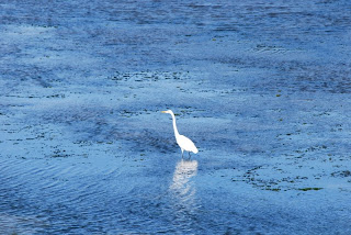
Great Egret. Notice the deep blue color of the water. Water tempature in the bay is 58°F.

White Pelicans -

Thursday, October 9, 2008

Bodega Bay CA

Date: 10/7/2008
Location:Bodega Bay CA
Lat/Lon: 38°19.801'N 123°03.460'W
Weather:windy N 15-20 kts, sunny, 65 F

There was a 1 1/2 day window of good weather before the next front arrived so we left Fort Bragg in the late afternoon on Monday and did another overnighter to Bodega Bay. The NOAA weather forecast again understated the winds and we spent the night surfing in a following sea of 8-12' waves with the wind blowing NNW 25-30 kts. It's not as uncomfortable as pounding into the waves and once you get use to the motion of the waves overtaking and then passing under the boat, it was an ok ride. The swells were coming from our starboard (right) aft quarter so when a swell would overtake us the aft of the boat would rise up and be pushed to the port (left). As the swell passed under the boat the aft lowers and moves down the backside of the wave to the starboard as the bow rises. Our 46 Nordhavn has a very round bottom so her motion is smooth, not snappy like flatter bottom boats. She does move around a lot so in larger seas above 4' you need to get in sync with the motion and always have one hand holding on. After each passage, Linda and I both have sore muscles in our legs and waist from the constant motion and the body's natural instinct to fight against it.

Bodega Bay looks like southern CA, low brown hills, round, bushy trees and blue sky. For the first time it seems that we've finally reached a different area of the coast. The marina is relatively new and it doesn't smell of rotting fish like many of the fishing ports we've been at on the coast. There is a small town on the other side of the bay that we can walk to to get some groceries and do some shopping. Everyone has seen Bodgea Bay, they just may not know it. This is the location where Hitchcock filmed 'The Birds', not in New England.

There is a big front moving down the coast over the next few days with high winds and seas, so it looks like we'll be here at least through the weekend and that's ok with us. With the market falling like a rock, Bodega Bay is a nice place to go broke.

Wednesday, October 8, 2008

Pleasant overnighter from Eureka to Fort Bragg


Date: 10/1/2008
Location: Fort Bragg CA, Noyo River Basin
Lat/Lon: 39°25.440'N 123°48.082'W
Weather: High clouds, lite wind

We departed Eureka marina at 11:30 AM after a good (12 hour) night sleep. There was calm winds and sun as we motored out the channel against the flood tide. The bar was calm and we took a heading to go around Cape Mendocino, the most westerly cape on the lower 48 except for Cape Flattery which we rounded on August 31st. The seas built to 3-5' off of the cape but quickly flattened as we rounded the cape and headed south. We had a southerly current so we slowed the engine to 1250 RPM and still maintained over 5 kts. Fort Bragg is 100 south of Eureka, Humboldt Bay, which would take 15.5 hours at our normal cruising speed of 6.5 kts but we again were constrained by the currents in the bar. Humboldt Bay flooded until 1:15 PM and the flood in Fort Bragg started at 7:30 AM the following morning so we had nearly 18 hours to cover the 100 NM for an average speed of 5.5 kts. Added to the equation is that we wanted to get around Cape Mendocino, which has a reputation as being quiet nasty, in the daylight. Our plan was to leave early from Humboldt Bay to make the flood and hurry, if you can call 6.5 kts hurrying, around the Cape and then slow down for the remainder of the trip and arrive at Fort Bragg at day break.

On this trip the weather cooperated and was as forecasted so we had a nice overnight voyage. In the early morning I was getting very sleepy so I laid down at 6 AM for an hour and when Linda woke me she said it was a nice morning but the swells were very large. What we saw when the sun came up was swells up to 15' tall but over 15 seconds in duration so it was very gentle ride as we rode the swells up and down. We called the CG and they reported that the bar and channel had 2-4' swells and there were no restrictions so we proceeded in. The CG also asked for our boat name, description, documentation number, number of people on board, number of life preservers, and our GPS position. We pulled the stabilizer fish out of the water at the outer buoy and proceeded in. The channel is very narrow and turns sharply after you pass under the Highway 1 bridge and other than being temporarily blinded by the rising sun, we had a good trip across the bar and through the narrow channel. Once inside the channel we pulled up the paravane arms and made our way to our slip in the basin. The basin has narrow fairways and the finger piers are no longer than 40' so getting a 48' boat in was a bit of a challenge but there was no wind or current.

There is no wifi in the basin but there is wifi further up the river 1/2 a mile at a small boat basin that has a RV park. We use the SSB radio and SailMail.com to get text email and download weather forecasts. To get to a store we have to walk a mile up a steep hill but there's a nice shopping center and grocery store at the top. There is a winter weather pattern developing with high winds and seas so we might be here for a week or more waiting for good weather. Such is the life of cruisers trying to make their way down the coast. We hope that when we get below San Francisco the weather will improve and become more stable.

The over night trip from Hell.

The plan was to leave late in the afternoon today and cruise all night arriving in Eureka for the flood tide at 8 AM. The trip is 72 NM which will take 12 to 13 hours and we want to leave CC in daylight so that will make us 2 hours early arriving in Eureka. We'll just 'hang out' off the bar to Humboldt Bay until sun rise at 7 AM and then we'll call the CG and find out the bar conditions and if everything is ok, we proceed in. It's 72 NM from CC to Eureka and flood tides this week are occurring in the morning so we needed to arrive in the morning hence the overnight trip. The weather forecast was for winds SSW 5-10 kts so we were looking forward to an easy trip.

We departed CC at 5 pm in 5 kt winds and had a route laid out that would take us 15 NM offshore so we wouldn't have to worry about crab pots. Once we were offshore we turned south as the sun went down. At 10 PM I went to lie down and Linda was on watch. Around midnight I was awaken by the boat pounding into waves and I came up to the pilothouse to see how Linda was doing. We were off Trinidad Head (41°02.910'N 124°19.800'W) and the wind and seas had started building over the last hour, the wind was now SW 20-25 kts and the seas seemed to be steep and 6-8' in height. We reduced the engine by 100 RPM and that somewhat eased the motion of the boat. I decided to stay up and see how things developed, plus I wouldn't be able to sleep with all this going on. At night it is very difficult to tell what the waves look like, how high and steep they are, but we could see white foam on the wave tops and we were taking spray over the bow.

In the next hour the wind continued to increase and the seas were building and Linda started to feel seasick. Quickly she progressed from feeling a little queasy to violently vomiting in the aft head. She was very sick and spent the rest of the night either kneeling in front of the head or lying in the passage way outside of it. I remained on watch as the seas built and the winds reached 40-45 kts and the sea became very steep and over 12' high. The boat was taking spray over the pilothouse as she pounded into the waves yet the boat was handling it well and although we were uncomfortable, especially Linda, we were in no danger. I continued to reduce the engine speed trying to ease the pounding with little effect. Our main concern was what would we do if we could not get across the bar at the Humboldt River and into Eureka. The next port was Fort Bragg 100 NM further down the coast and we didn't want to continue like this for another 16 hours.

By 6 AM we were off of Humboldt Bay and the seas and winds had come down as we came closer to shore. We're not sure if the high winds we experienced were caused by a passing front that was heighten by Trinidad Head or was just an off shore disturbance and had we been closer to shore we would not have had the high winds. Whatever the cause, as we approached the shore off of Eureka the wind died down to 10kts and the seas to 3-4'. We still had an hour to sunrise and 2 hours to the flood on the bar. We cruised 3 NM past the bar entrance and turned around with the seas coming from behind us and the boat motion calmed way down and Linda started to feel much better. I called the Coast Guard and they reported 2-4' swells in the bar entrance with no restriction. We easily crossed the bar and once in the channel pulled up our paravanes and made our way up to the marina on Woodley Island across from town. Once tied up at the dock and registered we both collapsed in bed for 4 hours, safely secured to a dock. That night we both slept for over 12 hours, recovering from the rough night.

In the morning we both felt refreshed and decided to continue onto Fort Bragg. The marina at Woodley Island in Eureka had little to offer other than a nice restaurant but it was a long distance to any shops in town so we decided to continue while the weather was good.

Friday, September 26, 2008

Crescent City CA


Date: 9/24/2008
Location: Crescent City CA
Lat/Lon: 41°44.929'N 124° 11.010'W
Weather: fog this morning, sunny afternoon, calm winds

A pleasant cruise down from Brookings to Crescent City, calm winds, near flat seas, and fog. We had no more than 1/2 mile visibility for most of the trip and could not see any of Point St. George just north of Crescent City that has large rocks extending out 6 miles offshore.

We were in Crescent City in November of 2006 for 3 weeks waiting for good weather when we brought the boat north from Dana Point. We had bought the boat in October and had difficulty finding an insurance company to cover us for the trip north. Insurance in southern CA, no problem. Coverage in WA, no problem. Coverage for the trip up the coast in November, no way! We finally found a company through an agent in Seattle that was willing to issue a policy for the trip as long as we hired a delivery captain and one crew member, in addition to myself, to make the trip. They had to pre-approve the resume of the captain and mate and be informed when we were underway and when we were in port. As it turned out it was an uneventful trip expect for waiting in Crescent City for 3 weeks.

The port here is almost all commercial fishing and crabbing boats, but it seems very quiet compared to Ilwaco and Coos Bay commercial fleets. There is some activity on the boats but most are just sitting idle waiting for the crab season to open after Thanksgiving. We seem to be the only pleasure boat here at this time. We're spending our time working on a broken VacuFlush head and walking the mile into the shopping district and getting some groceries. Maybe we'll catch a movie while we're in town.

Our next stop is Eureka on Humboldt Bay. The bar entrance can be treacherous and should only be crossed during flood tides. For the next week flood only occurs in the mornings, so we plan on leaving here Saturday or Sunday in the late afternoon and arrive in Eureka in the early morning on the flood. Another overnighter but we'll arrive in daylight this time. Linda's starting to really like these night runs.

Sunday, September 21, 2008

Bandon to Brookings


Life is not a journey to the grave with the intention of arriving safely in a pretty and well preserved body : but rather to skid in proclaiming " WOW - WHAT A RIDE!"

Our 'plan' was to go from Bandon to Port Orford, a bay on the coast on the south side of Cape Blanco. There is a small community there but no marina, just an anchorage that is well protected form northerly swells and wind. We left Bandon at noon and after a very comfortable ride we arrived at Port Orford around 5 PM. The problem here was that the swells were coming from from the south west and the anchorage was rolling with 4-5' swells and the bottom was hard with kelp beds so we didn't feel we could get a good anchor set. So what to do now? What was plan B? The next port was Brookings, 46 miles south which would put us in there after midnight. We could follow our new friends on Voyager to San Francisco but I was low on coffee and wouldn't make it for 3 more days. So it looks like Brookings is the best option, I called the Coast Guard at Chetco River in Brookings and they reported that the bar was calm and we'd have no problems getting across. We gave the CG our boat name and told them we would be there between midnight and 1AM. We had called the Port at Brookings earlier in the day and they said they had lots of room on the transit dock and gave us instructions where to tie up. Being the intrepid adventurers that we are, or are becoming, off we headed into the night and a midnight arrival at a new port.

The trip was non-eventual with a beautiful sunset over the ocean and a nearly full moon rising over the land. When we were 6 miles out of Brookings we called the CG and they reported that the bar was still calm and wished us a good passage over the bar. We had expected the CG to offer the come out and guide us in and were a little surprised when they didn't offer but we felt confident that we wouldn't have any problems. We carefully laid a course for the outer channel buoy and went over our plans for when we would pull the paravanes up and what buoys we needed to identify. Our plan was to slow to an idle and pull up the paravanes between the outer buoy "CR" and buoy "2". As we approached the "CR" buoy there was a loud noise as a paravane fish caught a crab pot and pulled the rigging tight. We immediately pulled the throttle back and put the engine into neutral. I went to the aft and could see we had snagged two commercial pots on the port side and the fish was being pulled tight out of the water as we dragged the pots across the bottom. As the boat slowed I pulled in the fish with the electric winch and fortunately was able to easily unhook the pot floats from around the fish with no damage to the fish or rigging. I then pulled the starboard fish out of the water and went up on the top deck and pulled the paravane arms up. Back in the pilothouse, we both took a few minutes to calm down, let our heart rates return to somewhere near normal and regain our focus on the task at hand in getting across the bar and through the channel.

Brookings has range markers, two bright red lights, one low and close to shore at the head of the channel, the other higher and back a 1000' feet. You line up the two lights, one on top of the other and follow that line straight down the channel. That combined with our GPS and chartplotter made it easy to get a fix on the channel and proceed in. The channel is 100' wide with rock jetties on either side. We slowly made our way down the channel and were able to get in without any problem. What you don't realize is how dark it is at night and how little you can see. If it doesn't have a light on it or directly above it, you don't see it, so things tend to appear right next to you out of the dark. It's a little nerve racking to say the least. We would not recommend entering a port that you have not been to before in the dark and will not do it again unless it's absolutely necessary. Once we were safely tied up we sat down with a beer and a glass of wine and were thankful we had such a tuff little ship that could take 10' 'sneaker' waves and snagging crab pots and just shake it off and keep going. We wouldn't trade Discovery for any other boat out there.

Bandon, OR


Date: 9/18/2008
Location: Bandon OR
Lat/Lon: 43°07.250'N 124°24.693'W
Weather: Sunny, lite winds

Bandon is a beautiful little sea side town with a well kept, quaint 'old town' that has a lot of tourist shops, every 4th storefront seems to be a coffee shop but that's ok. They're all newer buildings with a weathered sea side style. The downside of Bandon for boaters is that the bar is considered the most dangerous on the Oregon coast. We went in there from Coos Bay after a short 4 hour run on a very calm day and had a very nice bar crossing.

The next morning at 8 AM, on the ebb tide, there were waves breaking half way across the bar. We waited until the flood started and the bar looked better with waves breaking only on the end of the jetties. We cautiously proceeded outward, the bar at the end of the jetties had 3-4' gentle swells but in another 100' we were faced with 10-12' 'sneaker' waves that were steep sided and breaking 50' feet on either side of us. I slowed the boat and her bow quickly rose up the face of the wave and down the backside then up and back down on the following wave. Wow! Not a drop of water over the bow just a quick up and down hobby horse motion with the wave tossing the boat like it was a cork.Following this was a period of lower, round swells and then another set of steep sided, sneaker waves. One more set of steep waves and we were out of the worse of it and into deeper water. As the swells move toward shore and the water starts to shallow to under 50' even gentle ocean swells can become tall and steep 'sneaker' waves. We liked Bandon a lot and would highly recommend a visit but by car not by boat.

Once we were out into deeper water, over 100', the swells lowered and we settled into a leisurely cruise. About 30 minutes out we saw, and nearly ran over, a sunfish, Mola mola. This is a large flat fish that floats on the surface of the water, the one we saw was around 3 x 2 ft in size but they get much larger. We saw it's flipper sticking up and then as we passed it we saw the shape, strange fish. We also saw a 6' shark swimming in circles like it was chasing it's tail.

Coos Bay OR

Date: 9/16/2008
Location:Coos Bay OR
Lat/Lon: 43°20.811'N 124°19.332'W
Weather: foggy night and morning, low clouds in the afternoon

After 13 days in Ilwaco first waiting for mail and then the weather, we left Monday 9/15 and traveled 29 hrs and 186 miles to Coos Bay Oregon. We decided to skip Newport and the other small harbors between the Columbia River and Coos Bay because we wanted to get as far south as we could during this good weather. 'Good weather' being low sea swells and mild winds not necessarily sunny and warm weather. We have come to the conclusion that the WA and OR coasts are to be endured not enjoyed by cruisers. The harbors are scattered and problematic in anything less than ideal seas and there is not much to see or enjoy of the coast from the sea side. In a car it's a different story.

We crossed the Columbia Bar at 9:30 AM just after it turned to flood and it was very mild, 2-4' long period swells with W 5 kt winds. We were told by the fisherman on the dock in Ilwaco that there shouldn't be any crab pots out there this time of year but just in case, we should stay outside the 50 fathom line so we stayed in about 350' of water, 6 to10 NM offshore the entire trip and the only pots we saw were a group of very old ones off of Tilimook. Monday evening the fog came in and visibility was around 1/4 mile the entire night. Thank goodness for a good radar. We had to dodge a fishing boat off of Newport, he was heading inward toward shore and would not answer numerous radio calls so we turned 90 degrees to starboard to avoid a collision. We passed about 1/2 mile from each other and all we could see was the glow from his fishing lights. We passed a few other fishing boats and tugs but nothing exciting. The seas picked up around night fall but calmed down in the evening and by morning it was as calm as our entrance into the Columbia. We called the CG outside of Coos Bay for bar conditions which were 1-3' with no restrictions but we did not get inspected when we got in. Coos Bay is similar to Ilwaco in that it's mostly commercial boats although there are 5 or 6 sailboats here, all heading south except for one heading north. The docks here are filthy, covered with seaweed and gull droppings. Locals come down to the docks to crab and when they pulled their pots they just toss the seaweed onto the dock and leave it there to rot. That combined with the cigarette butts and gull droppings make it a very unappealing place.

We did meet another very nice couple, Chris & Judy on Voyager, a 1990 46 Nordy. They had tried to get fuel around 3 pm and then leave for SF but the fuel dock was closed so they pulled in behind us on the dock. We had some tea with them in afternoon and then a glass of wine and then around 7:30 PM the fuel dock opened and they got some fuel, $3.57/gal, and then came onto Discovery for another glass of wine then went back to their boat at 9:30. They left for SF at 6 AM the following morning and we left around 11 AM for Bandon just 20 miles down the coast.

Ilwaco - A nice visit from family

My brother and wife, Norm & Pat, came down Friday with their camper and spent two nights at the state park on Cape Disappointment. We spent most of Friday and Saturday with them and I had breakfast with them before they headed home. It was good to see them and spend some time visiting.

The marina at Ilwaco started to look dirty and run down by the time we left. It was good to get out of there and move on.

Sunday, September 7, 2008

Ilwaco - The fishing fleet is in port.

Date: 9/7/2008
Location:Ilwaco
Lat/Lon:
Weather: sunny

The port is filling up with commercial fishing boats that have been forced off of the coast because of high winds and seas. After dark last night a 55' fishing boat squeezed into the slip next to us with less than 12" to spare. He did an excellent job of bringing his boat in with a 15 kt side wind and he never touched us but we did have a few moments of high anxiety. He came over afterwards and apologized for the noise for having to run his generator and pumps all night but he had fish in the hold and had to keep them fresh. We understood, we're in their house here and we can't complain when they do what is necessary to earn a living.

Fun & Games:
Thursday we went to the local museum that focuses on Lewis & Clark items (it's free on Thursday). Thursday evening was an Art Walk through the local art galleries. Ilwaco has a surprising number of galleries and they were all serving complimentary wine. Fun!

Friday had a classic car event in town. They had what they called a 'slow drag' in the evening. It was a little hard to figure out but it was kind of like shuffle board with cars. They start off on a quarter mile track and then had to start gliding at a certain point and the closest to the line at the end won. No braking aloud. It was fun and there were a lot (30 maybe) of neat old cars to look at.

Sunday: We walked out to the Cape Disappointment light house and state park. It was a little too hot and the walk was a little too long and up and down hills but other than some sore muscles and one blister (on my right foot, second little toe in from the outside) we survived. Bring on the Ibuprofen.

The latest weather forecast is for high winds through Tuesday and then maybe a break. We hope to get out later in the week, we'll see what the weather does. If it's too rough for the commercial guys out there it is definitely too rough for us. We're 'weather wimps' and proud of it. On the other hand, Ilwaco is nice but we don't want to spend the winter here.

Saturday, September 6, 2008

Ilwaco WA


Date: 9/6/2008
Location: Ilwaco, WA
Lat/Lon: 46.3030°N 124.0411°W
Weather: Mostly sunny, windy

We made it to Ilwaco, Wa. Our first leg down the coast, 160 NM and 24 hours non-stop. We made this trip with a buddy boat, Jim & Naty on Nirvana, a 49 Defever pilothouse. They live in the Portland area and keep their boat on the river and have made this trip many times before so we followed their lead. I had been on the coast when we brought Discovery north after buying her in Dana Point CA in October 2006 but then we had a captain and another mate on board. Linda stayed at home for that trip. This time it was just the two of us. Being on the ocean is much different than boating on the inside passage where we have most of our experience and being on the ocean at night is very different from what we were use to. The ocean is always moving with swells from 3 to 6 feet in height, on a good day, and 6 to 10 seconds in duration from peak to peak. With the paravane stabilizers in the water the motion is easy and predictable but in order to walk around you always need one hand to hold on, the boat would lean 10° side to side with some 20° swings when a large swell passed under. During the night we each got a little sleep, me more than Linda. We both stayed awake for the sunset and first couple of hours of darkness getting use to being out at night and then I laid down on the pilothouse berth for 2 1/2 hours while Linda stood watch. Linda then went down to the mid cabin berth and managed to sleep almost 3 hours after which I slept for another 3 hours. We arrived at the Columbia River bar at noon, an hour after the start of the flood tide. You always want to cross a river bar on the flood tide so we timed our departure from Neah Bay to arrive at the Columbia bar on the flood tide. Thanks to the timing and fair weather, crossing the bar was a non-event. Jim & Naty then went onto Astoria a few miles down river and we pulled off in Ilwaco. After tying up we realized how tired we were and after registering at the office we both laid down for a nap followed by hot showers, dinner, and early to bed for a good night sleep.

Before leaving Neah Bay we fueled up at the Makah Mini-Mart fuel dock for $3.75 gal, no sales tax thank you, and then pulled into the Makah marina for the night. We now have enough fuel to make it well into Mexico. Being in the marina made it easier to talk with Jim & Naty about the plans for the next days passage to the Columbia River. The downside was that the marina smelled like diesel fuel and dead fish. The anchorage in Neah Bay is good, the marina is old, dirty, and stinks.

In Ilwaco we are in the land of commercial fisherman. There are only a few pleasure boats here and most of them are sport fishing boats. The marina has filled up as more of the commercial boats are forced off of the water due to the high winds on the coast. Most of them hope to get out on Monday. There is a fish processing plant here where the fisherman sell their fish and buy ice and salt. We enjoy being in with the commercial guys, they are generally a friendly and hard working group.

The 7 day forecast has high winds and seas until late on Wednesday and then starts to calm down so we hope to get out of here on Thursday and get down to Newport. We'll see, the weather can and will always change.

We posted some more pic's on our Web Photo Album, link on the right.

You gotta love this -

Wednesday, August 27, 2008

Getting ready to go


It looks like we'll have a weather window open up this Monday to get around the corner so we're going to leave Port Angeles tomorrow, Thursday, and go to Neah Bay. We'll get fuel at the Makah Indian fuel dock, recent price of $3.75 gal vs $4.50 in Port Townsend. The reason fuel is so cheap in Neah Bay is that the Makah's don't pay state tax so we'll save nearly $400 getting enough fuel to take us all the way to Mexico and then some.

On Monday, friends of ours that are on their boat Nirvana here in Port Angeles are heading out to go to their home in Portland so we're going to follow them around Cape Flattery Monday and go non-stop to Ilwaco, WA. For those of you following our route on Google Earth that's from waypoint WA175 to WA512 without the stops in between. We're a little nervous about having our first ocean passage being an overnighter but it's easier this way than trying to time the tides for entering and departing La Push and Grays Harbor. We were looking at the tides trying to calculate what times to leave La Push or Grays Harbor on a flood in order to arrive at the next port on a flood and it just doesn't work out so going straight to Ilwaco will eliminate that problem. The weather looks good with sea swells under 5' so we should have a good passage

The Oregon coast has more ports that we can stop at than Washington so it will be an easier and more interesting trip after this first leg.

Monday, August 25, 2008

Waiting in Port Angeles


Date: 8/25/2008
Location: Port Angeles
Lat/Lon: 48°07.498'N 123°27.068'W
Weather: Cool 58 F

We arrived here two days ago and will stay until Tuesday morning when we leave for Neah Bay. The weather in the Straits of Juan de Fuca are moderate but on the coast it's still blowing with 8-10' swells. Before we head around the corner we would like the swells to be lower than 5'. The 7 day forecast has the seas laying down next Sunday the 31st so we're going to wait in Neah Bay for a few days but be ready in case the seas improve before Sunday. If you look at a chart of the winds vs. the sea heights they do not move in sync, the winds can decrease without a corresponding decrease in the sea heights which can be affected by storms far out in the Pacific. It's the 'butterfly in China flaps it's wings and causes a hurricane in Florida' concept. Look at http://www.buoyweather.com and go to the Buoyweather Regions>United States>Washington and click on a red buoy dot off the Washington coast. That's what we're watching trying to determine when it's the right time to head out. We're getting anxious to get out on the ocean and start down the coast but we don't want to do anything foolish, we're going to be patient and wait for good weather. Too many people get into trouble or have an unnecessarily rough trip because they got tired of waiting and headed out before they should have. On the other hand, you don't want to be too cautious and miss a good weather window. So here we sit, hoping we're doing the right thing.

Port Angeles marina is a rather small but clean and well kept boat haven that, despite it's size, has quite a few mega yachts stopping over here. The reason some stop here is that Westport Yachts, a major yacht builder, is located here and Westport yachts will stop here for warranty work and repairs. As you can see from the photo, there are two large yachts moored just in front of us, the boat directly in front of us is 130' Westport, Miss Sydney. We feel like a pygmy in the land of giants.

Thursday, August 21, 2008

Port Townsend


Date: 8/21/2008
Location: Port Townsend
Weather: Periods of rain and wind and sunny and calm. A little bit of everything.

We've spent 5 nights in Port Townsend working out some problems with the water maker, getting supplies and spare parts, and spending a nice evening with Linda's cousin Jill who was nice enough to take us out to dinner and show us her new house in Port Ludlow. The weather out on the coast is predicted to blow a little the first part of next week so we're in no hurry to get out to Neah Bay and sit for 4 or 5 days waiting for the seas to calm down. Better to sit here and Port Angeles before heading out to the coast. We plan on leaving Friday for Port Angeles and spend a couple of days there before heading to Neah Bay.

The photo is of us, on the left, in our slip with a very nicely converted fishing boat next to us. This is the 'commercial' section of the marina although there were just as many pleasure boats, mostly sail boats, as there were commercial fishing boats.

Thursday, August 14, 2008

Coastal Itinerary & Routes


Date: 8/13/2008
Location: Friday Harbor
Lat/Lon: 48°32.480'N 123°00.780'W
Weather:Sunny and warm

We've added a new link with our planned coastal itinerary and a download of our routes in Google Earth format. In Google Earth, if you don't have it you can get it at http://earth.google.com/, you can see our navigation route with waypoints down the coast. A waypoint is a location you aim for in your route, each one labeled with a unique name. In our future logs we will refer to specific waypoints so you know exactly where we are. Right now the route only extends through Oregon, we will post the complete route when we're finished entering it in the computer. In case your wondering, we didn't just make up these routes and waypoints, they're from the book Exploring the Pacific Coast by Don Douglass & Reanne Hemmingway-Douglass, the bible for making this trip.
The planned route is a list of towns we plan to visit with the distance between them. The 'hours' is approximately how long it will take us to travel between them at 6.5 kts per hour, about 8 MPH. There are obliviously more places along the coast but these are the best places to stop if you're not planning any overnight passages.

Wednesday, August 6, 2008

Moment of doubt

As we headed south with the market falling like a stone and fuel prices rising without end we began to think that perhaps it would be prudent to delay our trip to Mexico for a year and hope for better financial times to come. In fact that is what we decided to do. We announced our change of plans to our family and friends and made plans to winter over in Friday Harbor. We would need to buy a car and we'd want some sort of TV to while away the long, cold, windy winter nights but it was not difficult to stay and dream of leaving next year. While making these plans we discovered a kind of glum had come over us, it was like we were giving up on our dream. We told ourselves it was only a delay of one year but what would happen if next year the market was still down and fuel prices high? Would we wait another year, and another until the dream had passed and we started talking about moving ashore?

No! Now is the time! The boat is ready and we're ready, the market will rise or fall wherever we are so we might as well be in Mexico spending our last dime on tequila in a bar on the beach than sitting in the rain and cold of the PNW waiting for just that right moment to leave. So we're heading south, now is the time. If the finances don't work out than so be it, but we have a felling they will. Better to live the dream than regret you didn't try. We had our moment of doubt but found the strength, or foolishness, to take the riskier course. We'll see how it ends.

"Twenty years from now you will be more disappointed by the things you didn't do than by the ones you did do. So throw off the bowlines. Sail away from the safe harbor. Catch the trade winds in your sails. Explore. Dream. Discover." - Mark Twain

Monday, August 4, 2008

Back in the San Juan Islands


We're back in the San Juan Islands in the Pacific Northwest. I haven't kept up on posting our progress so I'll try to list some of our favorite places along the way.

Note: We added a link, to the right, for our 'Alaska 2008 Trip Summary'. This is a day by day listing of each place we visited during our 103 day trip to Alaska.

See our Web Photo Album under 'British Columbia Southbound' for more pictures of these locations.

Tuesday June 24, 2008
Location: Nettle Basin, Lowe Inlet off of Grenville Channel
This is a beautiful bay with a large stream entering in the back. Contrary to the guide books, we had a difficult time getting the anchor to set in the south side of the bay but we were able to get a hold in the north east corner. The bottom seemed to be hard rock with a thin mud covering. It was a calm night and we had a lot of room around us so we didn't have any problems.

Saturday June 28, 2008
Location: Boat Inlet off of Reid Passage, BC
Lat/Lon: 52.3085°N 128.3726°W

This is a small lagoon that you enter through a narrow passage that you have to transit on the upper half of the tide. We went through with 8 feet under our keel at the lowest point. Once inside you are rewarded by an unspoiled bay not a quarter of a mile across surrounded by old growth forest. We were the only boat there and when I got up at 2 AM to check the anchor it was so dark that I could not see the shore, I had to turn on the spot light to locate the tree line. The sky was full of stars unlike any night sky you can see in the city. In the afternoon we went for a short walk on the rocky beach and then returned to our dink to continue exploring the bay. 10 minutes later when we looked back at the beach that we were just on there was a black bear not 100 feet from where we had been. He was the largest black bear we have ever seen and no matter how close we came he would not look up or run off. He spent 30 minutes eating the long fresh grass on the shore before he turned into the trees. Linda may never walk on a shore in a wilderness area again.

Wednesday July 2, 2008
Location: Rounding Cape Caution and Blunden Bay

There is an old saying, 'fog is your friend' because it normally brings calm seas. Well, we had a lot of friends coming around Cape Caution and the following day crossing from Blunden Bay to Port McNeill. We have 2 very good radars and AIS (Automatic Identification System) so we can see other vessels, the problem is other boats, especially small go fast fishing boats, running into us. On two occasions we had to stop the boat because we saw small boats approaching us quickly that would have run into us if we hadn't changed course. These little boats don't have radar and didn't see us until they were less than 100 feet away when they would turn sharply to avoid us.

Thursday, Friday, Saturday July 3,4,5, 2008
Location: Port McNeill

We really like Port McNeill, a small town on the North East coast of Vancouver Island. It's well kept marina is right next to the shopping area with a good grocery store, coffee shops, and restaurants.

Monday July 7, 2008
Location: Beaver Inlet off of Loughborugh Inlet

With the Spring currents in Johnstone Strait opposing us we decided to go into the back channels and discovered a great anchorage in Beaver Inlet. This is a well protected, long bay that has good holding. There is a cabin and dock at the head of the bay with a float home on the other side but once you are in the back half of the bay there is no evidence of other people. We shared the bay with one other boat that was courteous enough to anchor well away from us.

Wednesday July 9, 2008
Location: Von Donop Bay, Cortes Island

With a blow coming, we decided duck into this well protected bay for a couple of days. As with all of Desolation Sound at this time of year the bay was crowded with summer cruisers but there was adequate space and we spent two nights swinging in the wind. The outboard motor on our dinghy was starting to run rough and fuel would leak out of the carburetor after a few minutes of use.

Sunday, Monday, Tuesday July 13, 14, 15 2008
Location: Newcastle Island, Nanimo, BC

We anchored on the edge of this busy anchorage and rocked and rolled as many boats sped by us as if we weren't even there. I worked on the outboard motor but only succeeded in dropping a critical part into 20 feet of water. Not a good day. We called around and ordered the dropped part from a dealer in Bellingham WA. We did have a nice meal at the Dinghy Dock restaurant.

Friday, Saturday, Sunday July 17, 18, 19 2008
Location: Squalicum Harbor, Bellingham WA

Windy city, every day the wind would start out at 5-8 kts and build to 15-20 kts by late afternoon. We walked the 4 blocks to the outboard motor dealer to pick up our dropped part only to find that it didn't arrive because it was not in the Seattle warehouse and has to come out of Wisconsin which would take another week. We needed to get some groceries but there are no stores within walking distance of the marina but the marina has a shuttle bus and will take you anywhere you want in the local area. They took us to an excellent Heagen grocery store and we were stunned by the size and selection in the store. We were use to the medium to small stores located in the small towns up the coast so this was a shock. We also connected with some old friends, Peter and Carolyn, that we had not seen for over 2 years. They were staying in their RV just north of town and we spent most of two days with them. That was a nice treat. We didn't look forward to returning to Bellingham to pick up the part in a week, although the marina is cheap, so Peter and Carolyn offered to get the part and bring it to us in Anacortes. Nice people.
We go up at 5:30 AM on Sunday to try to get off the dock before the wind kicked up. The wind was blowing from our beam and pinning us against the dock. By 6:00 the wind was up to 5-7 kts but we were able to get clear of the dock. When we got out of the marina the wind increased and by the time we were into Bellingham Bay it was blowing over 40kts. The waves had built to 4-6 feet, this was some of the nastiest conditions we had seen all summer. The weather forecast had been for winds 10-15kts. As we got further away from Bellingham and into the San Juan Islands the wind decreased and it turned into a nice day. The marina in Bellingham is a great place but the wind really sucks, perhaps it you were a sailboater...

Friday, June 27, 2008

Back in Canada

Saturday June 21, 2008
Location: Pillsbury Bay, Prince Rupert, British Columbia
Lat/Lon: 54°19.233'N, 130°19.190'W
Weather: Hi 58°, Overcast and rain

Prince Rupert is the Canadian Customs port of entry for all boats entering Canada from Alaska and they have the most screwed up entry system of any city I've been in. To start with there is no public dock for customs, you must tie up at the Prince Rupert Rowing & Yacht Club marina, the public docks, which are full of local commercial boats, or, as we were told by a Canadian customs agent, in person, in May, you can dock at the Atlin Terminal dock. Once you're docked you must find a public telephone and call the customs office. Your cell phone will not work in PR because they have a private phone company and it does not accept calls from any other carrier. The PRR&YC is a private marina and is always full during the summer and nearly impossible to get into so we decided to take an open spot at the Atlin Terminal. After docking I walked up the dock only to find the gate locked with no way of getting to the phone both 20 feet outside the gate. There was no official looking person around so I turned to go back to the boat. Above my head was a sign that said 'Restricted Area, Authorized persons only!', 'Area under video surveillance.' Great, not only can I not get to the phone to clear customs but I'm an unauthorized person in a restricted area. So I walked back to the boat expecting a guard to appear at any moment when a lady leaned out of the boat docked in front of us and offered me the use of her security gate key to get the past the gate and call customs. For this persons protection I will not reveal her name or the name of the boat she was on but she has my eternal gratitude for her act of kindness.

Once you get Canadian Customs on the phone they are very professional and the process is simple and straight forward. When we received our clearance number we were off to Pillsbury Cove across the bay from town for a quiet night at anchor.
The next morning we we're off early for what we thought would be a long day. In the channel heading south out of PR the Canadian ferry 'Northern Adventurer' passed us nearly at full speed in the narrow part of the channel that is not ¼ mile wide. The wake from the ferry is 8 to 10 feet steep and a hazard to any boat in the area let alone to boats caught close by in the channel. The Canadian ferries are notorious for waking pleasure boats and I'm sure the crew got a big laugh seeing us tossed around by their wake. I just wish they would give the crew some lessons in common courtesy and seamanship.

Before we got to Grenville Channel the tide had turned against us so we decide to change our plans and head to a beautiful cove we had visited last year, Captain Cove (53.8097°N 130.1977°W) off the head of Petrel Channel. We stayed 2 nights here sitting in the rain and low clouds resting and waiting for better weather which never came.

Tuesday, June 24th, we continued south in Grenville Channel to Nettle Basin (53.5622°N 129.5726°W) in the back of Lowe Inlet. Nettle Basin is ½ NM round and 70-120 feet deep. We tried anchoring where the guide books recommend but the anchor felt like it was dragging across a hard, flat, rock bottom. After two attempts to set the anchor in the southern sided of the bay we tried a small bight on the northern side and the anchor seemed to catch. The forecast was for calm winds so we set the anchor alarm and settled in for the night. The weather was lite rain and low clouds with temps in the mid 50's. We are so looking forward to Mexico.

----------
radio email processed by SailMail
for information see:

http://www.sailmail.com

Thursday, June 19, 2008

Ketchikan AK


We've been in Ketchikan for the the last 3 days and hope to leave tomorrow, June 20th, to continue south. The weather here has been great, sunny and 60's, it looks like summer has finally arrived in SE just as we are leaving. We like Ketchikan and have done a lot of chores and errands while we've been here including a trip to WalMart and Safeway, and of course Starbucks.

I added a new album to our Web Photo Album, link in the left column, where I posted all of my pictures of commercial working boats from SE Alaska. I enjoy walking the docks looking at all of the fishing boats, old and new, rundown and freshly painted, and thought I would add an album dedicated to just working boats. I'll add more albums for each location we pass through.

Friday, June 13, 2008

Petersburg, AK


Location: Petersburg, AK
Lat/Lon: 56.8096°N 132.9672°W
Weather: Low 41°, Hi 50° F, Steady constant rain, Winds 5-10 kts

Hooray! We have wifi in Petersburg so I uploaded some new photos to the Web Album.

We left Goose Bay early Wednesday morning and cruised 10 ½ hours for 70 NM all the way to Petersburg arriving around 5:30 PM. After a rather dicey docking, not my best effort, we went to a Mexican restaurant/bar and Linda had a burrito and I had a enchilada. It's an odd little place, the restaurant and bar are two different companies but share the same building and space, they're only separated by the fact that the bar floor is one step higher than the restaurant. The food is served on paper plates with plastic forks and knives and if you want a beer you have to get up and walk into the bar and get it yourself. They still smoke in the bars up here. Alaska is big on individual rights and part of that is they don't prevent people from smoking in bars, and most people seem to smoke up here. There are limits though, there is a sign on the bar door that says -

No Dogs Allowed in the Bar. No exceptions!

Petersburg is a small town in a remote area of SE Alaska but it's fishing industry has the largest fishing catch, by dollar value, of any port in the US including the lower 48 states. That's a lot of fish. Things are busy around the port this week, the Dungeness crab season opens Sunday at 12:00 and the boats are busy loading pots and filling up on ice. Most of the people working on the boats are young men although some of the boats are family businesses with up to 3 generations working on them including the women. The young people that work the fishing boats live a very different life than young people down south.

Seems summer might be over. There was a lot of sun in May and now we're in a rainy windy pattern that is driving us south. We're tired of being cold and wet so were heading south two weeks earlier than planned. We still plan on spending two weeks around Anacortes and then heading down the coast the first of August rather than mid August.

We plan to leave here on Saturday and be in Ketchikan Wednesday and spend 3 days there before crossing into Canada.

Tuesday, June 10, 2008

Are we lazy cruisers?

We have been traveling with other boaters that seem to do a lot more than we do as we cruise around and it's started to make me wonder if we're not just lazy boaters. One couple we've been cruising with, Art & Diane, often come into an anchorage in the early afternoon, set their anchor, immediately lower the dingy from the top deck of the boat, take their dog, Lewis, to the shore to do his thing, rush out and sets crab or shrimp pots, go fishing for a few hours and then pull the pots and clean the catch and make a delicious meal.. While all this is going on we're taking naps, lazily working on some small boat projects, taking some photos and if it's not raining, we'll lower our dink and take a short trip around the anchorage. We love the traveling, the adventure of turning into a new bay, looking for the perfect anchorage and settling in once the anchor is down but we're not that crazy about eating crab or shrimp and fishing is fun but killing and cleaning the fish is not something I really like doing. Linda finds it strenuous enough deciding whether to defrost chicken or pork for dinner and finishing this blog entry is reason enough for me to take a nap.
Part of the reason I'm hibernating in the boat so much of the time is that it's just plain cold outside. Many days the temperature ranges from 42° to 48° F, the clouds are low and there's consistent lite rain or drizzle. I have little energy to go out in the cold and rain and do anything. Yesterday was 54° and that seemed exceptionally warm and nice. We talked to another boater a few days ago that said they went out to an island off of Sitka to do some fishing and no one was catching any halibut and "it just felt like winter" so they're heading south out of SE Alaska.
I guess we'll just have to go at our own pace and hope to get more active when the weather warms up.

----------
radio email processed by SailMail
for information see:

http://www.sailmail.com

Monday, June 9, 2008

How can the weather forecast be so wrong?

Monday, June 8, 2008
Location: Goose Bay, Port Camden, Kuiu Island
Lat/Lon: 56.7436°N 133.8691°W
Weather: Low 41°, Hi 54° F, Mostly Sunny, Winds 5-10 kts

After Deep Bay we went to Appleton Cove where Art & Diane showed up later in the afternoon. When had said our good byes in Sitka, they were waiting for a spare part and then heading to Juneau and we were heading south to Mexico. As it turned out they got their part the morning after we left and decided to get underway and made it to Appleton in one day when it took us two. Saturday morning we said goodbye to A&D again and headed out into Peril Strait to go down Chatham Strait a short distance to Cosmos Cove for the night. The forecast was for 15 kt winds from the SE, no problem, a little chop but basically a nice day. Boy the weather forecasters were way wrong. As soon as we came out of Appleton we ran into 4-6 ft waves and 30kt winds. When we turned into Chatham Strait the winds were sustained 25-30 kt, gusts to 45 kt and waves of 6-8 ft. Not nice at all. As we pounded into the seas the cats got sick and frightened, which is a terrible thing to happen to the poor kitties. You try to calm them but they don't understand the boat movement and the noise from the waves and wind and they get really scared. After 4 hours of the pounding we turned into Cosmos Cove (57.2433°N 134.8717°W) which offers little protection from the wind but is protected from the waves and provides a good anchorage. So there we sat for the night, wind howling thru the bay at 30+ kts, with us waiting for the 15 kt wind forecast to arrive which it finally did around midnight.

The next day was beautiful, lite winds and blue skies (the forecast for today was for 15 kt winds same as yesterday, that's 2 for 2 they missed by a mile) and off we headed across Chatham Strait for Halleck Harbor (56.9128°N 134.2228°W) on Kuiu Island. This is a nice bay protected from all winds except from West to Northwest. We were here last summer and it's a nice stop over for a night. We got a good hold on the bottom and the winds were calm overnight so we all slept well.

Monday we left at mid morning for a small unnamed bay Linda found in the guide book near Rocky Pass in Port Camden. The guide book calls it 'Goose Bay' because of the family of Geese living in the bay when they were there. On the chart it looks small and the entrance is twisted and shallow but it is a gem once you get inside. It's about ¼ by ½ mile in size and half of the bay is 35' deep. The other half of the bay is less than 10' deep so you need to watch the chart. It's nearly land locked so it's well protected from any weather and the guide book says there are lots of black bear in the area so we're on bear watch constantly scanning the grassy shore hoping to add to our collection of bear photos. We plan on staying here for a couple of nights before heading further into Rocky Pass. We'll let you know when we leave.

----------
radio email processed by SailMail
for information see:

http://www.sailmail.com

Friday, June 6, 2008

Leaving for Mexico

Thursday, June 5, 2008
Location: Deep Bay
Lat/Lon: 57.4464°N 135.6337°W
Weather: Hi 48° F, Partly Sunny, Winds 5-10 kts

Well not really, but we had a pizza party on our boat the last night we were in Sitka with our friends Art & Diane off of Kirkwall, Rick & Barb from Galatea, and later in the evening Eric & Sherry from Dolphin and we were asked "when are you leaving for Mexico" and I think it was Barb that said "tomorrow!". There is some truth to that, we're about at the northern apex of our Alaskan trip and we're starting to our trip south that will take us to Mexico and beyond. I'm starting to get excited about the trip down the coast and into Mexico and I'm spending more time reading the cruising guides of Mexico and planning the trip down the coast but it's a little early to get focused on Mexico and forget where we're at right now.
We had a late night, at least for us, and decided to make a short day of it today and stopped at Deep Bay after we went through Sergius Narrows in Peril Strait at slack tide at 1:00 PM Deep Bay is not a spectacular location but it is nice bay, good holding, and we saw 2 bears, maybe the same bear twice, before we turned in early. We need to slow down somewhat or we'll be back in Anacortes before the end of June so we'll start doing shorter days and spending more than one day at nice anchorages.

----------
radio email processed by SailMail
for information see:

http://www.sailmail.com

Monday, June 2, 2008

Sitka

Location: Sitka

Lat/Lon: 57.0622°N 135.3656°W
Weather: Hi 58° F, Partly Sunny, Winds 5-10 kts

I had planned to upload a slew of new pictures while in Sitka using our WiFi provider from down South, Broadband Express, aka BBX. We have had BBX for 3 years, paying an annual fee for unlimited service in most marinas south of Campbell River and including Sitka. Well, it's not working in Sitka, some sort of hardware problem that they don't seem too interested in fixing. BBX service has been deteriorating for the last year, over last winter in the Skyline marina in Anacortes it was hit and miss and they even stopped answering their support phone messages and emails. So I'm using my SailMail account and the SSB to send and receive emails. The connection is weak in the marina with all the other high poles and antennas and the electrical interference but I can get connected in the evening most times. SailMail is a great system but it works best when you are out on anchor and your antenna has a clear shot at the sky with little other electrical interference.

I've posted the last 3 entries from a hotspot in the local library in Sitka. I'll try to get some more posted, and maybe another batch of pic's to the web photo album, before we leave. The weather turned blowy so it looks like we'll be here until the end of the week which is okay because we like Sitka and there is lots to do here.

Appleton Cove


Tueday May 27, 2008

Location: Appleton Cove
Lat/Lon: 57.4689°N 135.2926°W
Weather: Hi 60° F, Sunny, 20 kts winds in Chatham Strait, 5-10 kts in Cove

We were in Appleton Cove twice last year and again this year and it is not very interesting, pleasant but not noteworthy except this time we had entertainment. As we entered the cove we noticed two bears across the grassy flats at the back of the bay and after we anchored the two bears started running across the flats, one bear seemingly chasing the other. After that one of the bears just hung around for the rest of the day, rolling in the grass and strolling from one end of the bay to the other. We have never seen a grizzly bear stay in one area for any length of time, let alone all day. It was great entertainment.

The photo is from Takaz Bay, not Appleton. We didn't get a good pic of the bear or the cove so I'm using this pic from Takatz.


Takatz Bay


Sunday May 25, 2008

Location: Takatz Bay, Baranof Island
Lat/Lon: 57.1350°N 134.8582°W

When something breaks or stops working and you find the part or the thing that caused the item to stop and you replace it and it starts working again than that's good. It breaks, you find the problem and fix it. What is not so good is when something breaks and you can't find the problem but the thing starts working again, all on it's own. It's good that it's working again but you just know that it's going to stop again and chances are that at some point it's not going to come back to life on it's own. This happened to us twice on Sunday. First the washer/dryer stopped working. Linda had just finished doing a load for Diane, that's another story all together, and put our own towels in to wash and after filling with water the thing just starts clicking, no action, just clicking. We checked the belt, it's ok, moved the dial all over the place, no good, nothing. So we let it sit for 5 hours while we cruise to Takatz Bay. After we get in and settled we fire up the GenSet and Linda turns the washer on and amazingly it starts working. Maybe it was just tired, overheated, something and now it worked. The second occurrence was just after we went to bed, we turn on a piece of electronics at the head of the bed that monitors the depth, wind, and location of the boat. Well it started beeping, the GPS part had failed and it was sounding an alarm. The item is an amazing piece of micro electronics. It has a GPS, compass, wind speed and direction detector, temperature and humidity and it's all in a container about the size of a Coke can. So we turned it off and went to sleep. The next morning it worked. No idea what went wrong or how it was made right.

Pybus Bay


Saturday May 24, 2008

Location: Cannery Cove, Pybus Bay, Admiralty Island
Lat/Lon: 57.3052°N 134.1553°W
Weather: Hi 60° F, Sunny, lite winds

Wednesday, 5/21, we left Petersburg and went a short (20 NM) hop to Thomas Bay and anchored in the lower part at the south end of Ruth Island ( 56.9805°N 132.8168°W). Thomas is a large bay some 6 miles deep East to West and 8 miles North South. Ruth Island is located within the bay and is nearly 3 miles long. At the northern end of Thomas Bay is Baird Glacier which has receded ¼ miles back from the waters edge and therefore doesn't calf ice burgs into the bay. Thomas Bay is very beautiful with steep sided cliffs and mountains rising all around. Unfortunately the day we were there was low clouds and rain and it was difficult to see much above the lower hills.

Thursday we went over to Portage Bay (57.0014°N 133.3209°W) at the northern end of Kupreanof Island. Portage Bay lacks the high mountains and because of that is not a spectacular anchorage but it is a wide open bay with good holding which we needed for the winds that were forecasted to last through the night.

Friday we left early to go to what turned out to be one of the most spectacular anchorages we have been in in SE Alaska, Cannery Cove on Admiralty Island. This is a round shaped bay surrounded by a bowl of mountains that go straight up from the waters edge. Shortly after we arrived we heard a low roll of thunder coming from the mountains and looked up to see an avalanche of snow cascading over a rock faced cliff about half way up the mountain side. Truly a special location. We'll post pictures the next time we have wifi.

The weather is predicted to be unusually sunny and warm for the next few days and we plan on staying here for at least two nights and then continue on our way towards Sitka.


Tuesday, May 20, 2008

Petersburg, AK


Tuesday May 20, 2008
Location: Petersburg, Alaska
Lat/Lon: 56.8096°N 132.9672°W
Weather: Hi 56° F, Sunny, winds 5 kts

After some windy and rainy weather in Ketchikan we've hit a patch of sunny and mild weather. From Ketchikan we went to Vixen Harbor ( 55.7988°N 132.1723°W) and sat out one day of heavy rain and wind gusts over 50kts. Vixen is a secure bay with good holding so we were safe and secure. From there the weather started to improve. We then spent two days in Santa Anna Inlet and then went onto Petersburg where the weather has been sunny and calm. Today may set a record high temperature, beating the old record of 55°.

On the way out of Ketchikan we stopped to take on some fuel at the Petro Marine fuel dock, the lowest priced fuel dock in Ketchikan. The price was $4.21 per gal including tax. Eight years ago oil was near $20 per barrel, today it's $127 per barrel!

Here's some stats on our trip from Anacortes, WA to Ketchikan, AK

Days Traveled – 31
NM Traveled – 713
Engine Hours – 112
GenSet Hours – 43
Fuel Consumed Total – 293 gals
Fuel Consumed by Furnace – 47 (average 1.5 gal/day)
Fuel Consumed by GenSet – 11
Fuel Consumed by Main – 236
GPH – 2.10
Average NMPH – 6.37

Note: NM = Nautical Miles = 6078 ft = 1.15 land miles


The schedule from here includes anchorages in Thomas Bay, Pybus Bay on Admiralty Island, Takatz Bay on Baranof Island, and then through Peril Strait to Sitka by June 1st.

Saturday, May 10, 2008

Ketchikan Alaska


Location: Ketchikan Alaska
Lat/Lon: 55.3502°N 131.6838°W
Weather: Hi 55° F Low 44° F, Overcast with rain. Winds 10-20 kt
Day 32, 713 NM from Anacortes

Note: Try the new link on the right for 'Web Photo Album' for more photo's.

Ketchikan is the first town that you come to when you enter SE Alaska by boat but it is not where you spend you first night in Alaska. It's 90 NM from Prince Rupert to Ketchikan, too long for a 7 kt boat like ours, so we, like many people, will stop in Foggy Bay (54.9504°N 130.9433°W) on the north side of Dixon Entrance. Foggy Bay is in AK but the US Customs recognizes that most boaters can not make it to Ketchikan in one day and will overnight in Foggy Bay so when you clear US Customs in Ketchikan you state that Prince Rupert was your last port of call.


One of the things that strikes me most when we get into Alaska is the number of eagles and how close they are. They are not some remote bird you watch through binoculars at a distance like you do down south in the lower 48. Up here eagles are like sea gulls in a southern city. Around the marina they fly so close you can hear their wings passing through the air. They are a striking bird, seemingly enjoying flying in and around the masts and high poles of the fishing boats, occasionally plucking a fish out of the water and sitting for hours above your head on light posts and masts.

We're going to stay in Ketchikan for a few days waiting for some packages from down south and for the weather to improve a little. A few days after leaving Anacortes our alternator regulator started to act up, letting the alternator put out over 15 v to the batteries. I called Balmar and after some discussion and testing they agreed to send a new regulator to us in Ketchikan. Fortunately we had a spare regulator, not a new 'smart' one but a functional, working one. We're also waiting for a new Pactor modem for our SSB radio. There's nothing wrong with the current one but we've had some issues with Radio Frequency Interference (RFI) and decided to upgrade to a Bluetooth version of the modem to try to reduce the RFI. The supplier for our SSB equipment (HFRadio.com in Oakland) agreed to send us a new Bluetooth modem and give us full credit for our existing modem. Thanks Don! The marina here will not accept packages for us so we're using a private mail store just down the street as a mailing address. They only charge $1 per package.

So here we sit in the rain and wind waiting for better weather and for packages to arrive. If the weather improves (no sign of that in the current 5 day forecast) then we might move on and have the packages forwarded to Petersburg. If not, we'll wait. One real nice thing about Alaska is that the marinas are cheap, $30 per day for us vs. nearly $70 in Canada.

More later.

Tuesday, May 6, 2008

Prince Rupert BC


Tuesday May 6, 2008

Day 23, 623 miles to date
Location: Prince Rupert, British Columbia
Lat/Lon: 54°19.233'N, 130°19.190'W
Weather: Hi 55° F Low 44° F, Overcast and rain

We're in Prince Rupert, less than 30 miles from Alaska. We've had a good passage through BC, mostly fair weather with low clouds and rain most of the time but lite winds and seas. We had a good crossing of Cape Caution in 2m swells but we had the paravanes down and the fish in the water so we, and the kids, were comfortable. Our anchor winch motor died while anchoring in Pruth Bay but the caretaker at the lodge was nice enough to let us tie up at the dock while we replaced the motor with the spare we carried. We stopped in the small outpost of Shearwater for a night and had a nice meal in the restaurant with Art & Diane. We were the only two pleasure boats in the marina. We spent a night at the old cannery Butedale. The moorage consists of tieing up to large logs held together with rope with boards nailed on the top to simulate a dock but the stop is worthwhile just to talk with the caretaker Lou who has lived here year around for the last 6 years. He is a wealth of local knowledge and loves to talk. He receives no salary for being the caretaker other than the moorage he collects and the proceeds from the sale of the art work he makes over the winter.

Prince Ruppert is a town of around 15K people whose existence is built around fishing and being the terminus of the only highway and railroad line to NW Canada. They have a huge bulk grain and coal loading terminal. We're waiting here for a weather window to cross Dickson Entrance, the large body of water that separates Canada and Alaska. Dickson can be a mess at times when storms pass over but like the other crossings we've made, we'll take our time and pick the right day to cross so we'll have fair seas.

Our HF SSB radio is working well and we're able to get emails almost daily via our SailMail account so if you have that email address please send emails letting us know how you're doing.

We'll post more when we get to Ketchikan, hopefully within 4 days.